Abram's Creek Lodge & Campground

Eco-Friendly Lodging & Camping

Stream-Front Wilderness Campsites, Cabins / Cottage, Tipi rentals & Lodging
Located off U.S. Rt. 50, 3 miles east of Mt. Storm, WV


Back to www.AbramsCreek.com


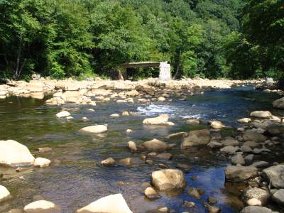
Places Nearby - Schell Road Swimhole and Laurel Run

on the N. Branch of the Potomac River, WV/MD & Laurel Run, MD


Distance from Abram's Creek Retreat: 5.0 miles


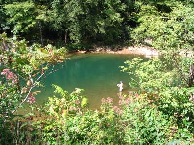
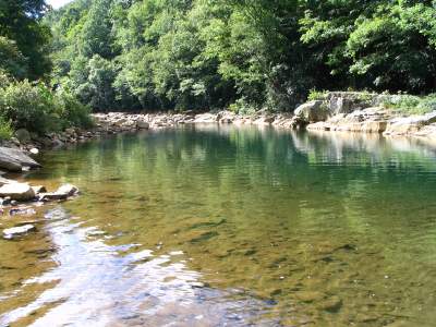
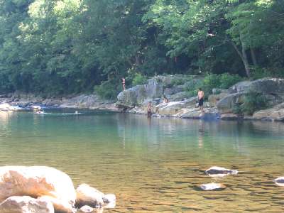
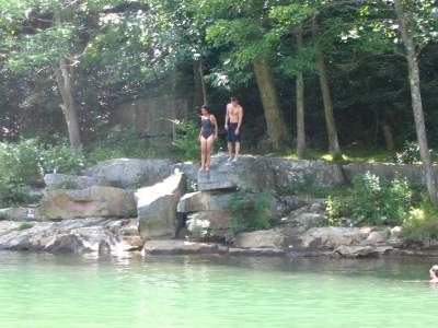
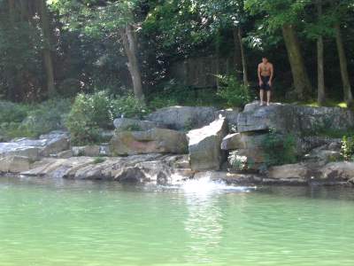
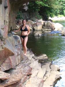
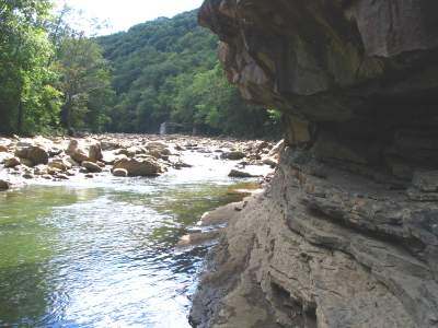
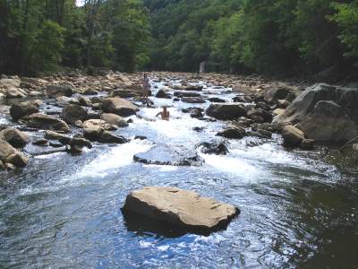
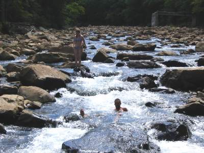
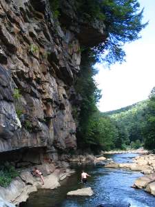
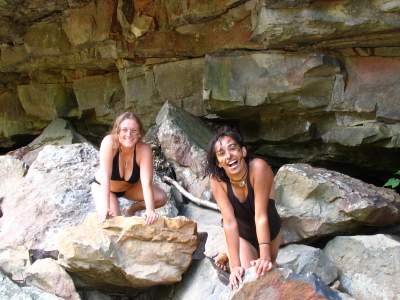
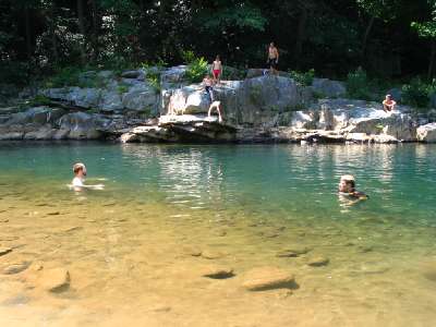
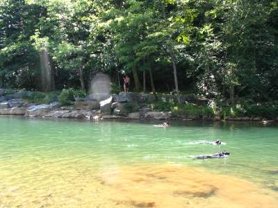
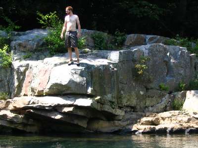
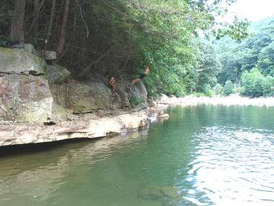
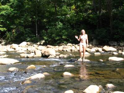
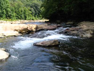
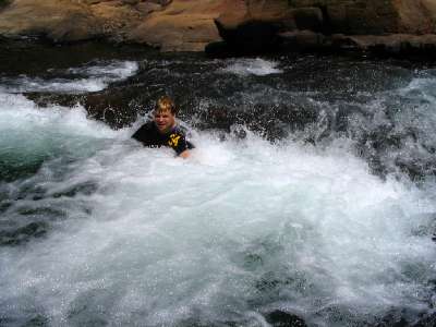
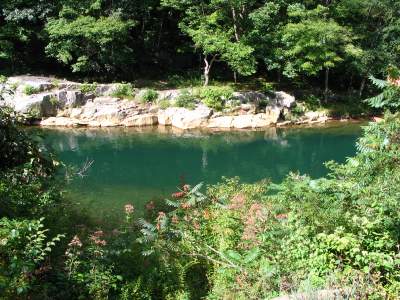
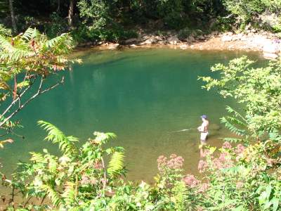
N. Branch of the Potomac River (Schell Rd. swimhole)
20-25 feet deep on cliff side
(See more photos of the N. Branch Potomac below)

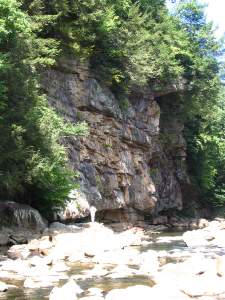
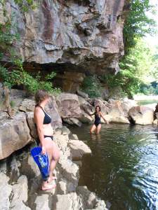
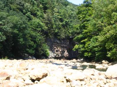
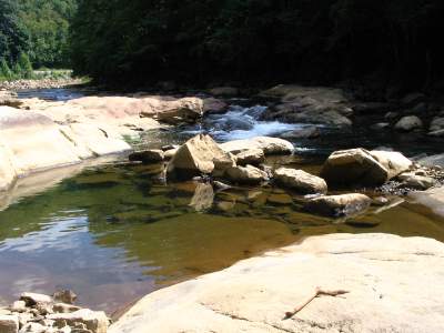
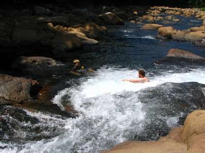
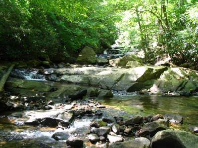
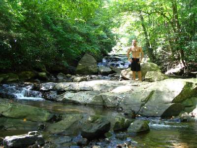
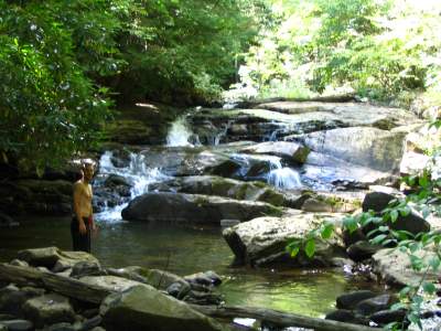
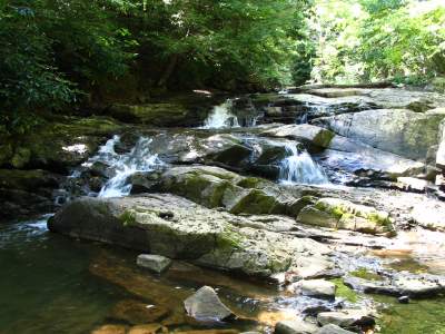
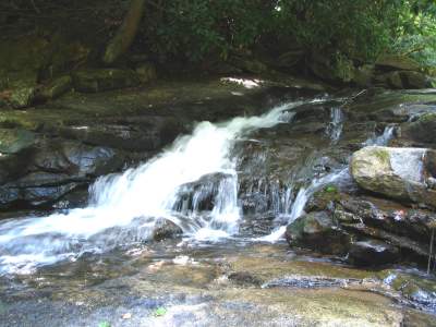
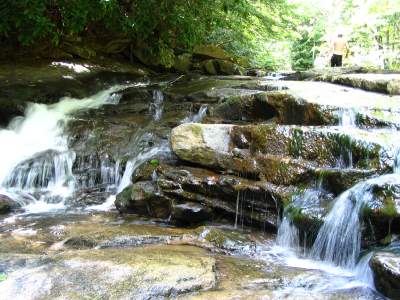
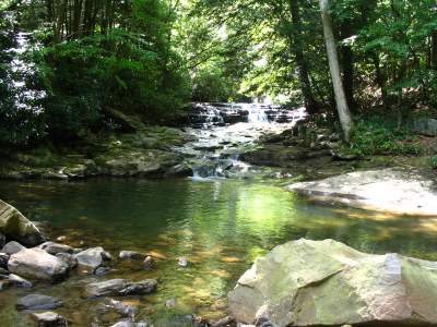
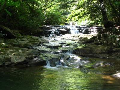
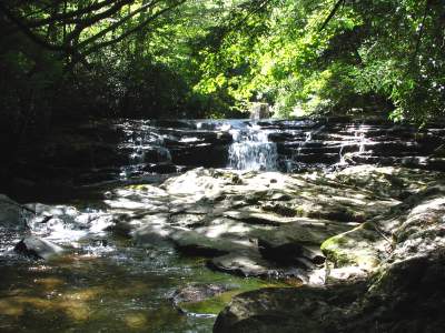
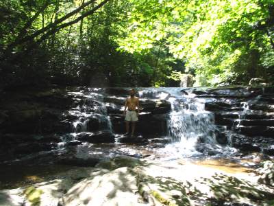
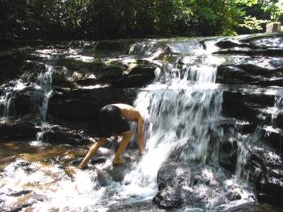
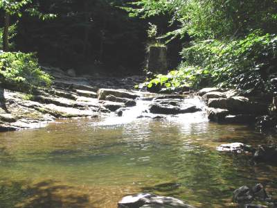
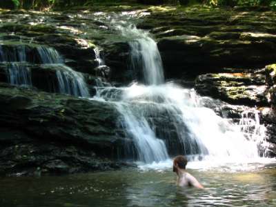
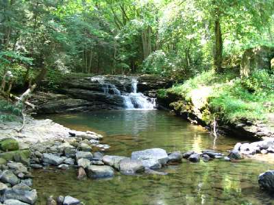
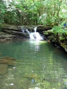
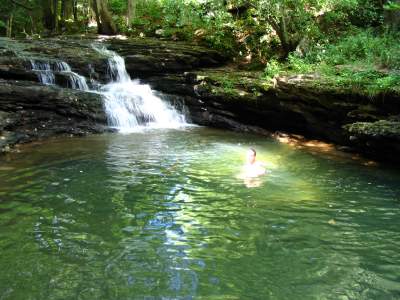
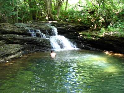
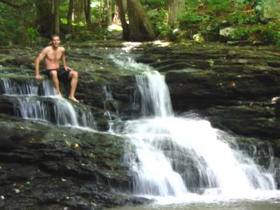
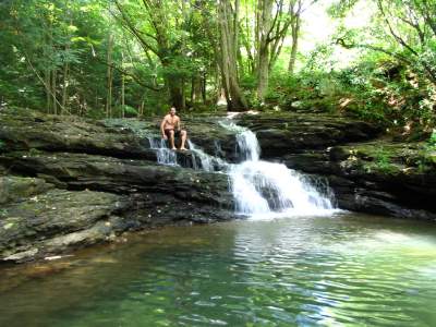
Laurel Run (MD) at the N. Branch of the Potomac
Waterfall and pool #4
(See more photos of Laurel Run below)


Distance from Abram's Creek Retreat: 5.0 miles

Description: Warm waters, waterfalls, rapids, water slides, deep swim holes, diving cliffs, scuba / snorkeling, canyons, caves. The photos below are of the North Branch of the Potomac River (WV / MD) and Laurel Run (MD), which enters the river across the parking area given in the directions below.
The N. Branch of the Potomac has warm waters due to the large sun surface area and from heat being stored in the stones & boulders that line the river.

Directions from Abram's Creek (high sitting vehicles only -- i.e. SUV's): Exit the gravel road of Abram's Creek Retreat and turn right onto U.S. 50 West. Go 0.2 miles and turn right (not left) onto Schell Rd. (marked on opposite side of road).
**Proceed for 4.7 miles to the N. Branch of the Potomac (at mile 3.5, keep left down the hill). Logging roads have recently been added and when in doubt, go downhill. (The first 2 miles of this trip are paved, the next 2 miles gravel and the last one mile earth and rock). As you approach the end, you will need to make a very hard left turn on the dirt road (180 degree u-turn), at which point you will be parallel to railroad tracks and the river. Proceed a bit furhter until your see an open area for parking and a picnic table, old fire rings and an old out house. Park here. Walk across the railroad track and take any trail down to the big water hole. The trail is steep. Go upstream or downstream about 1/4 mile to see the sights in the photos below. Cross the stream at low water (if possible) to get to Laurel Run just to the right of the destroyed concrete bridge pylon across the river).

Directions from the MD side -- on paved roads -- very car friendly (about 15 miles): Note: these directions are from mapquest and are not tested!). From Abram's Creek driveway, Take U.S. 50 West about 7 miles to Gormania (about 4 miles past Mt. Storm). Bear right onto Rt. 560 just over the Potomac River bridge. Proceed for several miles and turn right onto White Church Steyer Rd. (towards Kearney). Keep straight onto Audley Riley Rd. (veering off of White Chruch Rd.) -- then keep left again onto Laurel Run Rd. -- follow to end -- this should put you at top of 4th water fall -- follow stream down a few hundred yards to N. Branch of Potomac River. Caution: slippery rocks.

Driving Complications: The last mile of Schell Road is for 4WD or higher sitting vehicles only. Further, if it has rained recently, the last 2 miles may be very difficult due to slick and muddy/water filled roads. Steep descent. Laurel Run Rd. on the MD side is car friendly and paved.

Cautions: Photos shown are during low water conditions. After rains or during normal rainy seasons, the N. Branch of the Potomac River could have strong and dangerous currents and undertows -- exercise great caution in rivers!


Schell Rd. Swimhole -- North Branch of the Potomac


N. Branch of the Potomac River (Schell Rd. swimhole)
20-25 feet deep on cliff side

A different view
as seen from the shore


The railroad crossing from the parking area
to go down to the river

The jumping cliffs
on the Garett County side of the river


Indeed, people about to jump

One down, one to go


Some amazing river side
cliffs downstream

A close up of the cave-like
lower cliff area


another close up of the lower cliffs
and awesome pools

The view looking upstream
back at the bridge across from the parking area


The destroyed bridge across from the parking area

The cliffs as seen from upstream


Playing in the low waters in front of the cliffs

...and sliding in the current


More cliff views

...and the people under the cliffs


A crystal clear Potomac

Truly an oasis


Up close jumper Dustin


More downstream cliff jumping

...and a river crossing at low water (drought)


Beautiful upstream sunning rocks
with "spank your bottom" water slide in background

...and the "spank your bottom" river slide at low river levels
(could have dangerous currents at higher water levels)


Spank your bottom up close

frothy rapids at the end of slide


An old outhouse near the parking area

...and a final view from the railroad tracks


Laurel Run, near Schell Rd. swimhole


Approaching waterfall #1 along Laurel Run

...getting closer


Waterfall #1 up close

...low water levels due to drought


Waterfall #2

...and again showing it's full width


Just downstream of waterfall #3

and another view of the same


Getting closer to Waterfall #3

...waterfall #3 up close


Waterfall #3 up close again

...and just above waterfall #3


Waterfall #4 preview


Approaching waterfall #4 along Laurel Run

...and viewing it's large pool


More of the waterfall #4 pool

...and cars are parked just beside this pool


A final view of waterfall #4

...and Terry up close


...and Terry up close

A final view of waterfall #4


Note: This place is 5 miles from Abram's Creek Retreat & Campground.